
Long before white settlers began arriving in southwest Missouri, Native American tribes called the forested hills and plains of the Ozarks home. Archeological evidence of native people has been found to date back as far as 8000 B.C., including sites within what are now Springfield city limits.
The first historical records of Osage tribes in the area date to the late 1600s, and the Osage were known to live in the area until the 1800s. Other tribes include the Delaware who began emigrating to Missouri because white settlers in the eastern part of the country pressured Native Americans to leave. Other tribes also lived in the area, including Kickapoo, Shawnee, Piankashaws, Peoria and Weas.
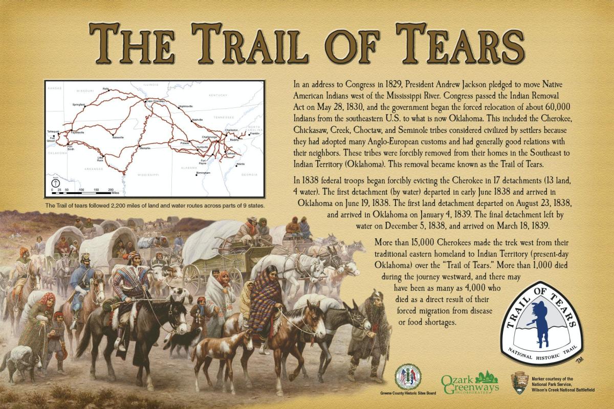
Trail of Tears
As the white population grew, Native Americans continually were forced out of their homelands in the east with the most notable push occurring when President Andrew Jackson signed the Indian Removal Act in 1830. Over the next several years, about 60,000 Native Americans were forced to leave their homelands for reservations in other parts of the country - primarily Oklahoma - over what became known as the Trail of Tears due to thousands of deaths that occurred during the forced marches.
The Trail of Tears, a National Historic Trail, took several routes from east to west across the country through Alabama, Arkansas, Georgia, Illinois, Kentucky, Missouri, North Carolina, Oklahoma and Tennessee. The route through Missouri included groups that came through Springfield. Portions of the trail can still be seen in the area, including at Wilson’s Creek National Battlefield, the Trail of Tears Park in Battlefield, and other locations.
Two half-mile sections of the Trail of Tears Greenway near Republic Road and Golden Avenue are preserved with a natural surface. Another completed segment that parallels the Trail of Tears begins at Nathanael Greene/Close Memorial Park and continues south to Battlefield Road. This half-mile segment is paved. Access the paved portion of the trail from the South Creek Greenway trail at Nathanael Greene Park. Please note there is only neighborhood access to the natural surface trail section and parking is limited.
Though portions of the trail that are available to the public are disconnected, efforts are underway by Ozark Greenways to make part of the Trail of Tears, and its cultural and historical significance, more accessible with a planned trail corridor beginning at Ewing Sports Complex at Bennett Street and Scenic Avenue and traveling south to Cloverdale Street, where future on-street connections will connect the trail to the city hall and city park in Battlefield.
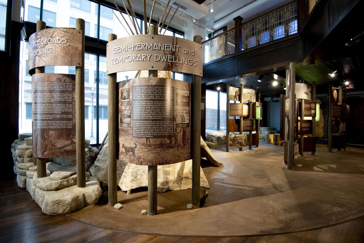
The Native American Exhibit at the History Museum on the Square
In 2020, the City of Battlefield was awarded a grant to add 1,400 linear feet to the Trail of Tears Greenway within Battlefield city limits.
Learn more about the area’s Native American inhabitants at the History Museum on the Square, 154 Park Central Square, where a permanent exhibit is dedicated to the history of the people who first lived in the Ozarks.
For more information about Ozarks Greenways, visit www.OzarkGreenways.org. Download your own map here.
More Resources


Itineraries
Explore curated itineraries featuring attractions, dining, entertainment, and...
Visit Page