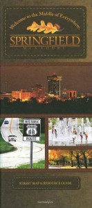
 A new Springfield Map is now available to assist visitors and new residents in more easily navigating the city.
The map features a comprehensive street-level view of the City of Springfield, Greene County and a detailed downtown inset. The map, produced in cooperation with Community Link, is available at three Springfield Information Centers – Battlefield Road and U.S. 65, downtown in the Jordan Valley Car Park and at the Springfield-Branson National Airport.
To access the map online, visit our website and click on “Springfield Area Map.” For information about advertising on future versions of the map, please contact Melissa Divincen at 417-881-5300, Ext. 105 or e-mail mdivincen@springfieldmo.org.


